Potential Tropical Storm Nine: Landfall on Thursday as Helene?
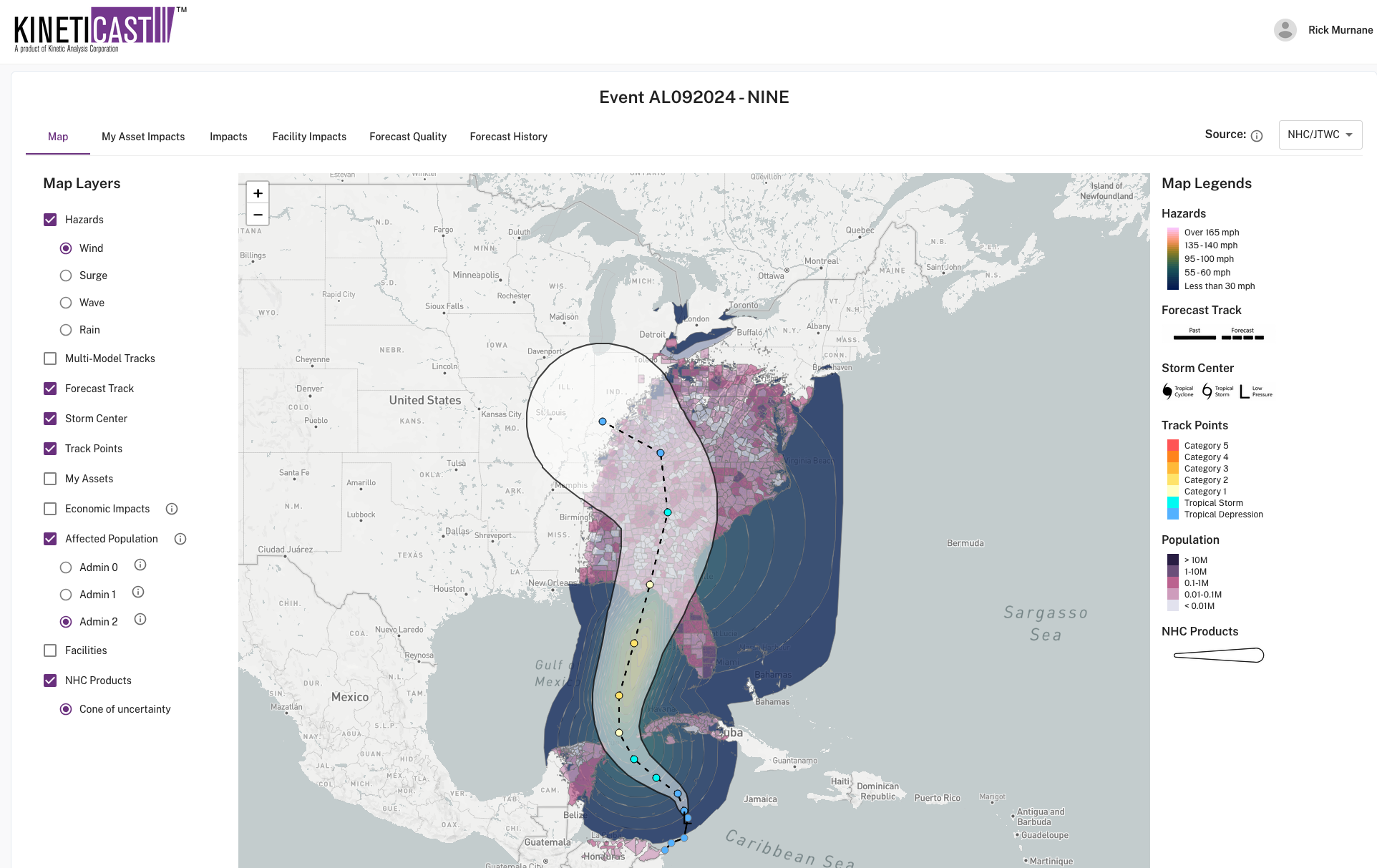
The National Hurricane Center (NHC) initiated warnings on Potential Tropical Cyclone Nine (PTC9), which could soon become Tropical Storm Helene. The NHC forecast and model guidance suggests a possible landfall late Thursday. People should pay attention the NHC’s “Key Messages” and act accordingly. On the way to landfall, the storm will move over the Gulf’s warm waters and deep mixed layer which will support intensification. As visualized with our web app, KinetiCast™, the forecast suggests that PTC9 will intensify.
The line shows the NHC forecast. Maximum wind footprint generated using NHC forecast and Kinetic Analysis Corp.'s ocean and atmosphere models. Affected population is for population exposed to winds of at least tropical storm strength. The polygons are at an Admin Level 2 (i.e., counties in the United States).
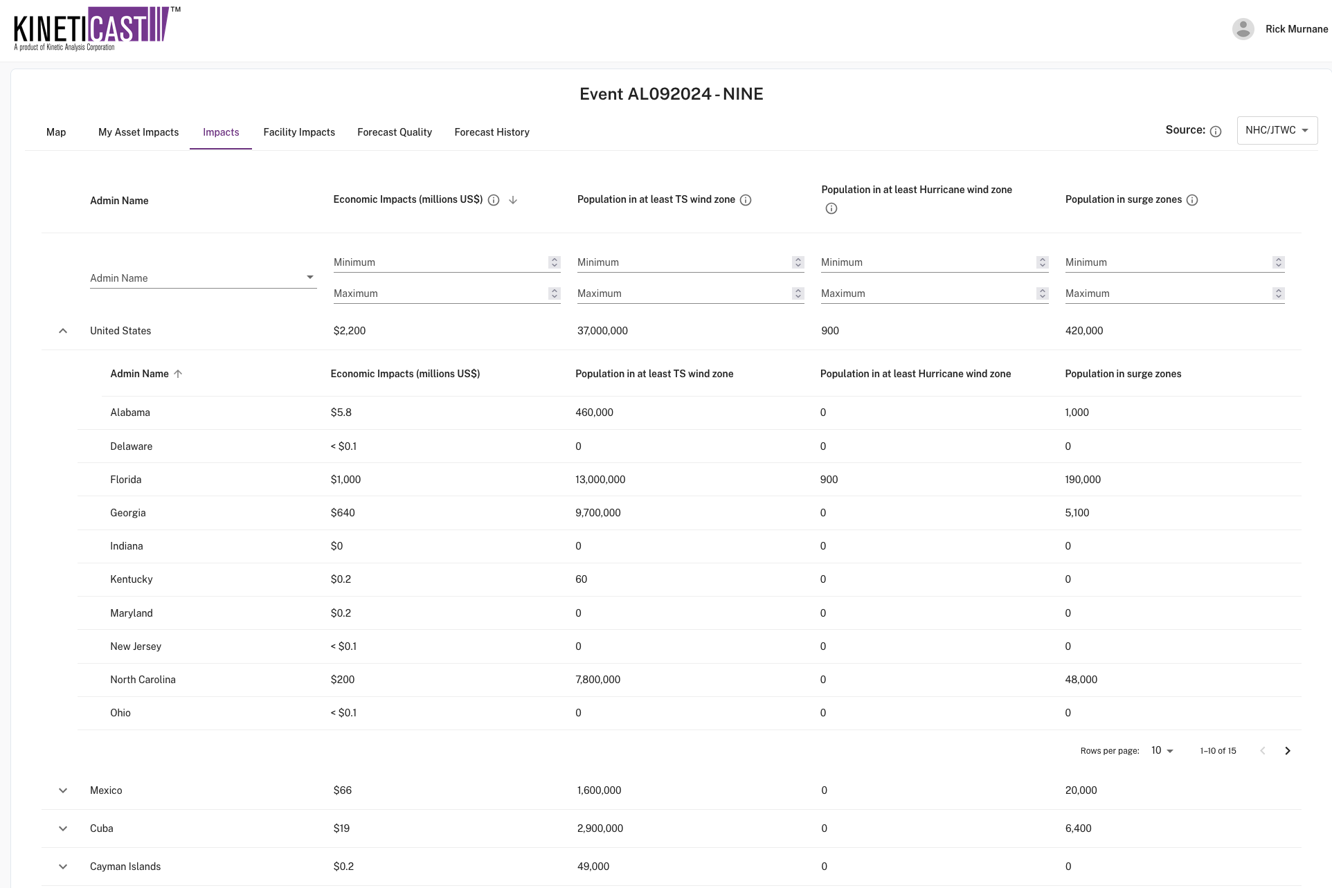
The data available through KinetiCast™ show that PTC9 could generate significant impacts with tens of millions of people experiencing tropical storm-force winds and hundreds of thousands of people in areas with storm surge.
Snapshot of impacts table from KinetiCast™.
If this type of information would help you maintain situational awareness, you can explore what KinetiCast can offer by creating a free account here.


