Extraordinary Hurricane Milton to Threaten Mexico and the Florida Coast
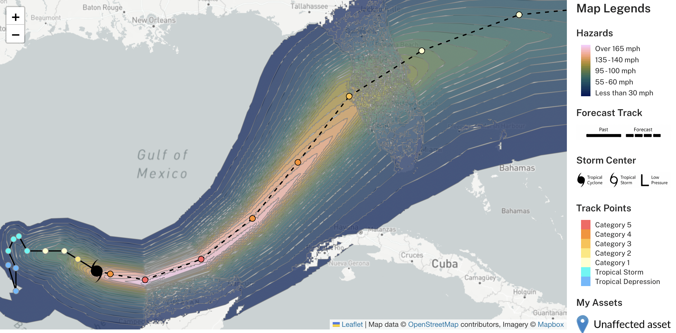
On Saturday, the National Hurricane Center (NHC) declared Tropical Depression 14 at 11 AM Eastern Time [1]. Since then, roughly 48 hours later, we now have a Category 5 on our hands. What’s worse, this storm is barreling toward the Gulf Coast of Florida, including places that were recently flooded from Hurricane Helene [2]. The first figure below shows the modeled maximum, 1-minute sustained wind field generated using our ocean and atmosphere models and the NHC forecast.
Past and forecast wind field for Hurricane Milton via KinetiCast. The wind is shown at a <2 km resolution and accounts for topography and land cover.
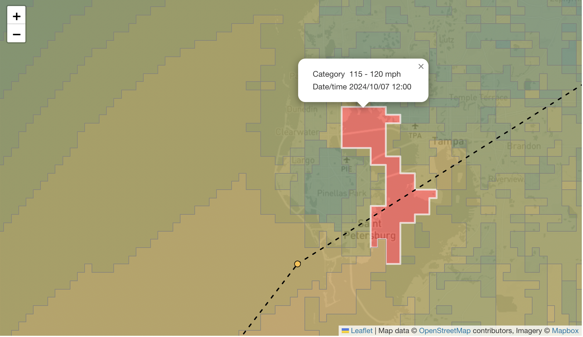
Zoomed-in wind field around Tampa, FL for Hurricane Milton. The red highlighted area shows where maximum, 1-minute, sustained winds of 115 - 120 mph may occur.
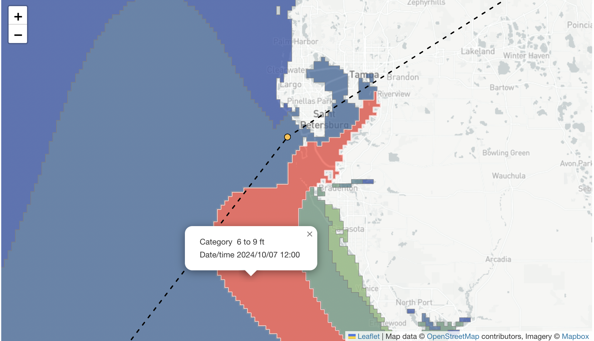
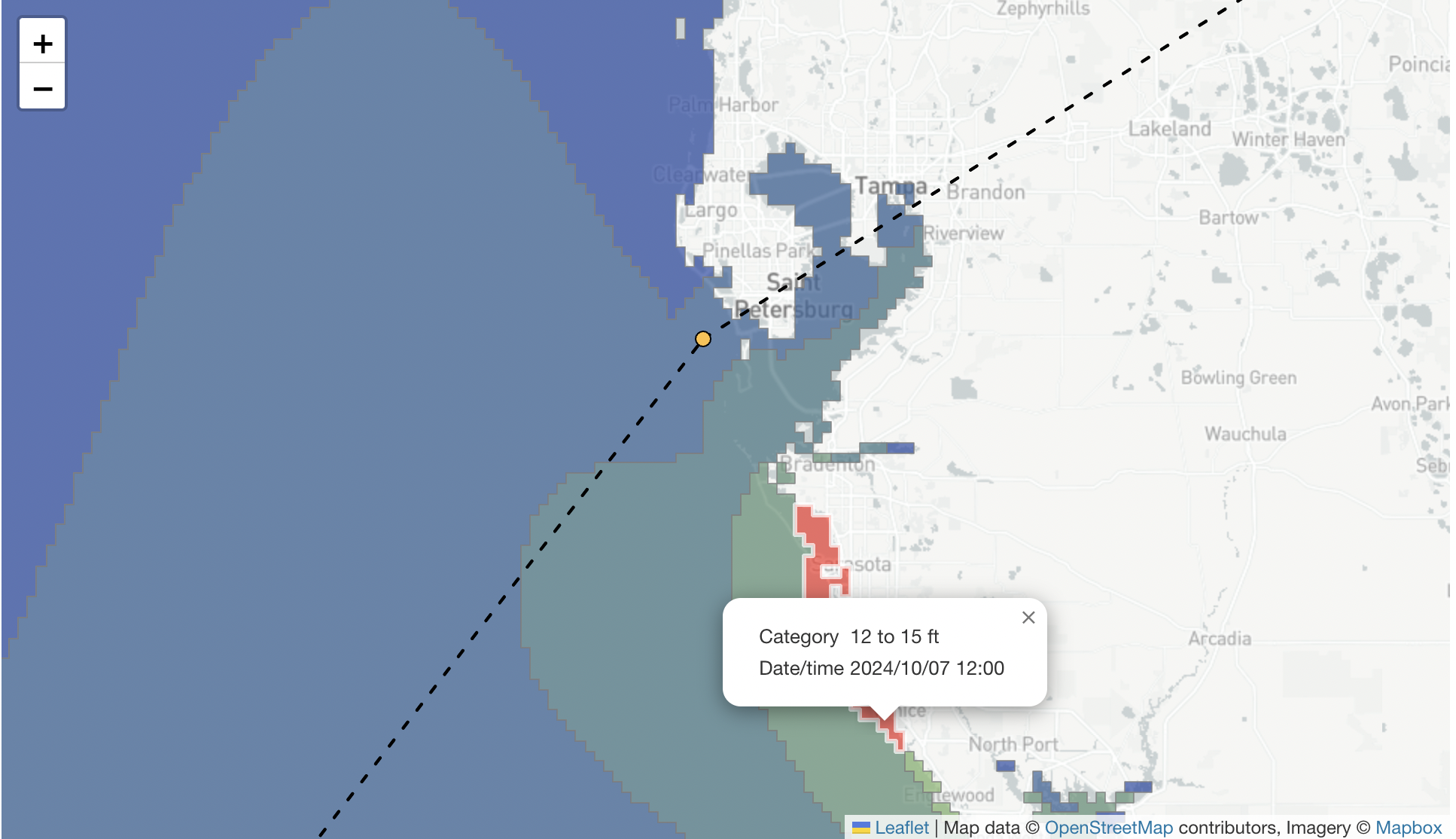
The figure above shows the potential wind we may see in portions of the Tampa Bay Area. As Milton is expected to weaken somewhat as it approaches land, we likely won’t see Category 5 winds that the storm currently has as we write this blog. However, over the next few days Milton is forecast to grow in size so that upon landfall, the area exposed to dangerous and damaging winds will expand. In addition, the larger storm will produce storm surge over a larger area. Our model results currently show a potential storm surge of 6 to 9 feet in Tampa Bay and as high as 12 to 15 feet further south near Sarasota.
Simulated maximum storm surge for Hurricane Milton generated using Kinetic Analysis Corporation models and displayed using KinetiCast™. The red highlighted area shows where 6 to 9 feet of water-level rise may occur. This accounts for the wind-driven water rise, astronomical tides, and the rising water level due to the lowering of atmospheric pressure. Changes in storm track could have a significant impact on the amount of storm surge.
Storm surge prediction for Hurricane Milton as depicted using KinetiCast™. The red highlighted area shows where 12 to 15 feet of water-level rise may occur. This accounts for the wind-driven water rise, astronomical tides, and the rising water level due to the lowering of atmospheric pressure.
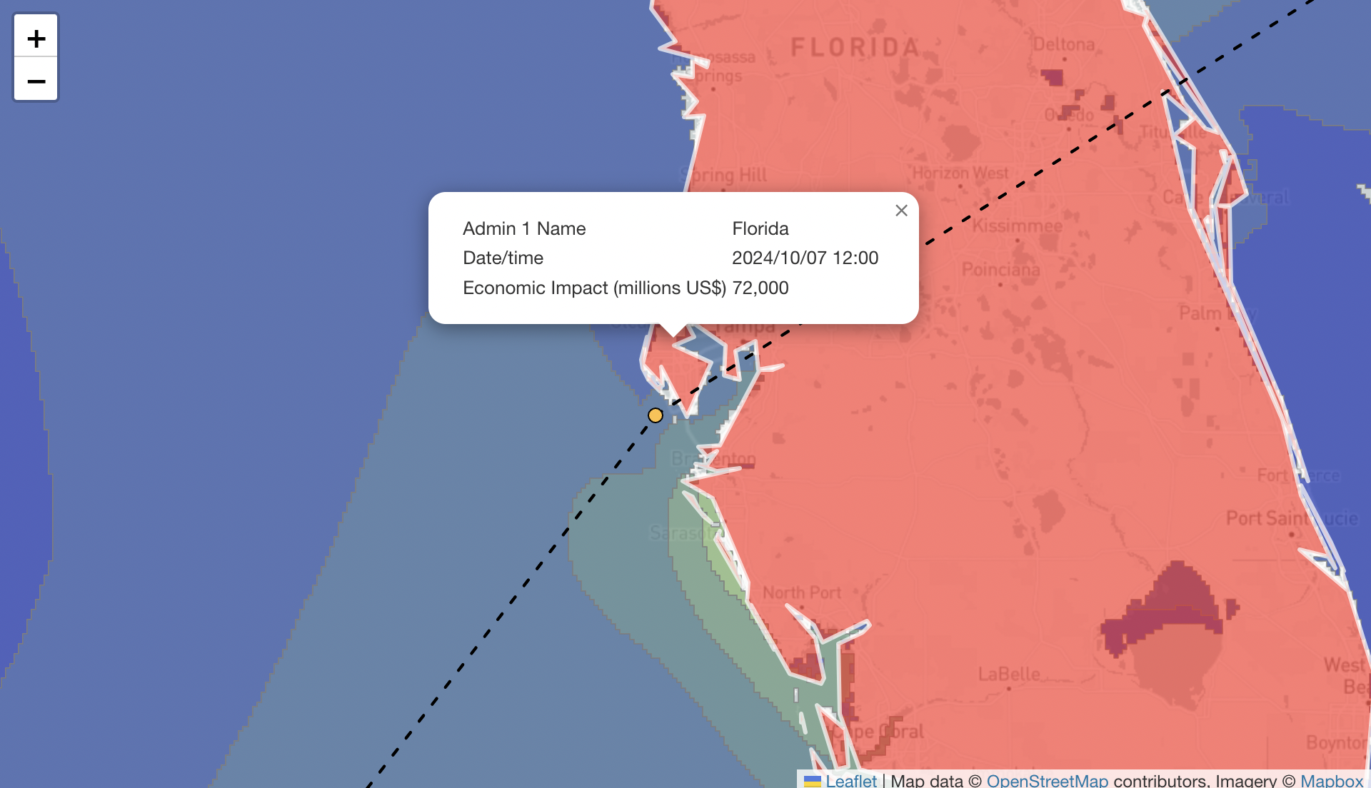
With regards to the potential for economic losses we may see, there is no doubt that Milton will be a costly storm for Florida. The magnitude of the loss depends largely on where the center of the storm (and the strongest winds and surge) track. If the storm indeed makes landfall in Tampa Bay and plows through the I-4 corridor, we could be looking at between 50 and 100 billion USD in economic impact. This is largely due to the densely populated counties and cities located along I-4, including Tampa and Orlando [5]. These areas have ballooned in population in the last few decades and, as a result, so have property values and infrastructure [5]. For a track like the one shown above and with a landfall at Category 3 intensity, over 70 billion USD in economic impacts could occur.
If the storm tracks a little further south, then the economic impacts will be less because of the lower population density and less development. However, this is not to downplay the cost to people’s lives and livelihoods that will occur nonetheless. As many forecasters and the NHC have stated, there is no win-win with this storm, and a significant and life-threatening impact is expected somewhere on the west coast of Florida by midweek.
Economic loss projection from Hurricane Milton in Florida via KinetiCast. The current forecast intensity and track result in an estimated economic impact of over 70 billion USD.
Milton has already been one for the record books due to how quickly the storm has spun up, increasing its wind speed by 90 miles per hour in just 24 hours [1]. This is well beyond the technical definition of rapid intensification, which is an increase of 35 mph in 24 hours [6]. It is plausible that the storm could continue to break more records as it treks east.
We hope everyone in the path of Hurricane Milton stay safe and prepared. Please refer to the NHC’s Key Messages (In English, en Español) for advice on what you should do. For any questions regarding our products, please reach out at aagastra@kinanco.com.
References
https://www.nhc.noaa.gov/
https://apnews.com/article/hurricane-helene-florida-storm-surge-0284042dade78e04e453ad821e6e15c3
https://www.weather.gov/mob/katrina#:~:text=Storm%20surge%20was%20as%20high,to%20east%20of%20Destin.
https://biotech.law.lsu.edu/katrina/reports/erpreport.pdf
https://www.wlrn.org/environment/2023-10-09/florida-population-hurricane-losses-building-codes
https://news.ucar.edu/132924/scientists-find-two-ways-hurricanes-rapidly-intensify

