
Tropical Season Heating Up Globally
The tropical cyclone seasons around the globe have started to heat up in recent weeks. Last week, Typhoon Hinnamnor claimed the title for the strongest tropical cyclone so far of 2022 based on wind speed. The storm brushed by the southern Japanese islands of Okinawa and Ishigaki between August 31 and September 3, bringing strong winds and heavy surf, before curving north and making landfall in South Korea on September 5 as a Category 2-equivalent typhoon.
Behind Hinnamnor, however, is a new tropical cyclone in the western Pacific which has the potential to become another powerful typhoon. Meet Muifa!

Past and forecast wind swath of Tropical Cyclone Fourteen (Muifa) from the Joint Typhoon Warning Center’s (JTWC) official forecast as displayed on Kineticast™.
The current expectation is for Inday to have maximum winds of 120 miles per hour on September 10. Unfortunately, its projected path also takes it close to some of the same southern Japanese islands that were lashed by Typhoon Himmamnor. According to the wind field on Kineticast™, the island of Miyakojima could see sustained winds as high as 110-115 mph. Right now, current losses are expected at 245 million USD, but these will likely change and will be updated on the Kineticast™ web app as the storm evolves.
Elsewhere, Hurricane Kay in the eastern Pacific continues to approach the coast of Baja California. According to the Kineticast™ snapshot below of the forecast wind swath of Kay, the storm will likely bring tropical storm conditions to most of Baja California as it passes by.
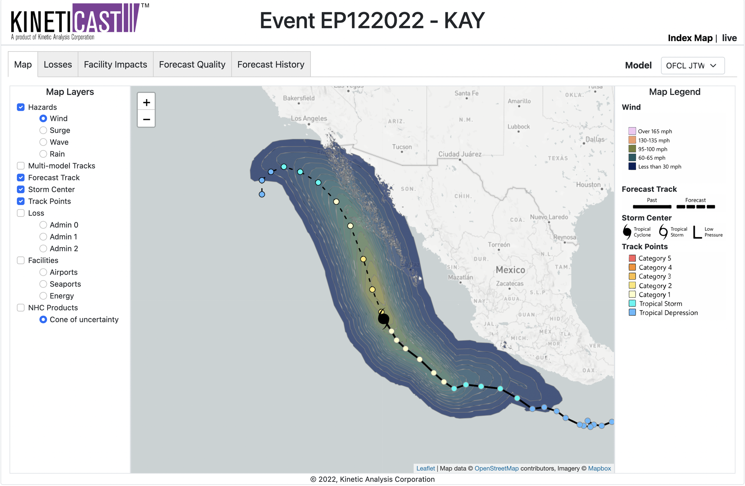
Past and forecast wind swath of Hurricane Kay from the National Hurricane Center’s (NHC) official forecast as displayed on Kineticast™.
Furthermore, the zoomed in Kineticast™ snapshot of forecast wind for Kay shows that parts of the peninsula, particularly Bahía Tortugas, Bahía Asuncíon, and Punta Prieta, could experience winds of hurricane force as high as 85-90 mph.

Zoomed in Kineticast™ snapshot of forecast wind swath from NHC official forecast of Hurricane Kay, with the coast of Baja California in view.
At the moment, the forecast economic losses for Hurricane Kay are 59 million USD, primarily in Mexico. Changes in loss numbers and other impacts will be updated on the Kineticast™ web app in real-time as the storm progresses. If you are interested in seeing it in action yourself, please reach out to sales@kinanco.com.