Typhoon Muifa Makes Landfall in China; Nanmadol Poses Threat to Japan
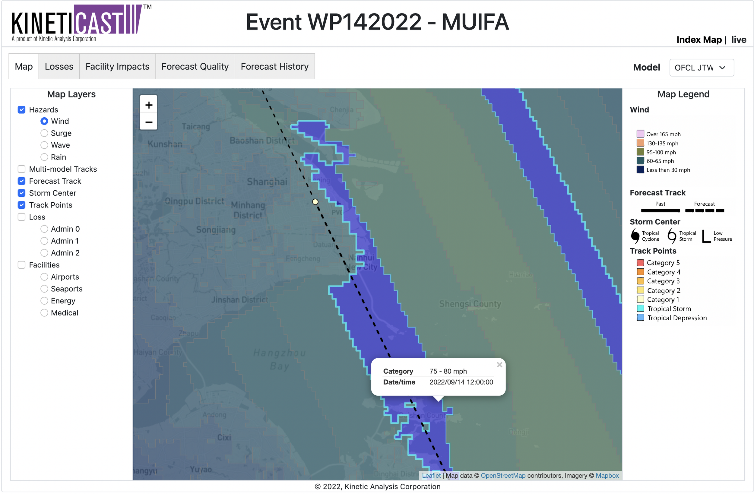
On the evening of Wednesday, September 14, Typhoon Muifa made landfall on the east coast of China, bringing strong winds of nearly 100 miles per hour. The landfall point was near the archipelago of Zhoushan, and the storm is now progressing toward the Chinese coastal city of Shanghai. Millions of people are currently bracing for torrential rains and potentially deadly flooding from Muifa. Winds in and around Shanghai could be sustained at as high as 80 miles per hour as Muifa closes in.
Forecast wind swath (zoomed in on Shanghai) of Typhoon Muifa, generated by KinetiCast™ models using forecast data from the Joint Typhoon Warning Center (JTWC). The winds shown here are 2-minute sustained winds at 10 m adjusted for terrain.
Based on a forecast issued by the JTWC, losses from Muifa on Kineticast™ are estimated to be about 11 billion Purchasing Power Parity (PPP) in USD. PPP is used to allow for quick comparisons between countries of different economic levels. In addition to Muifa, another tropical cyclone (Nanmadol) in the western Pacific Ocean is expected to become a typhoon with winds of 100+ miles per hour in the coming days.
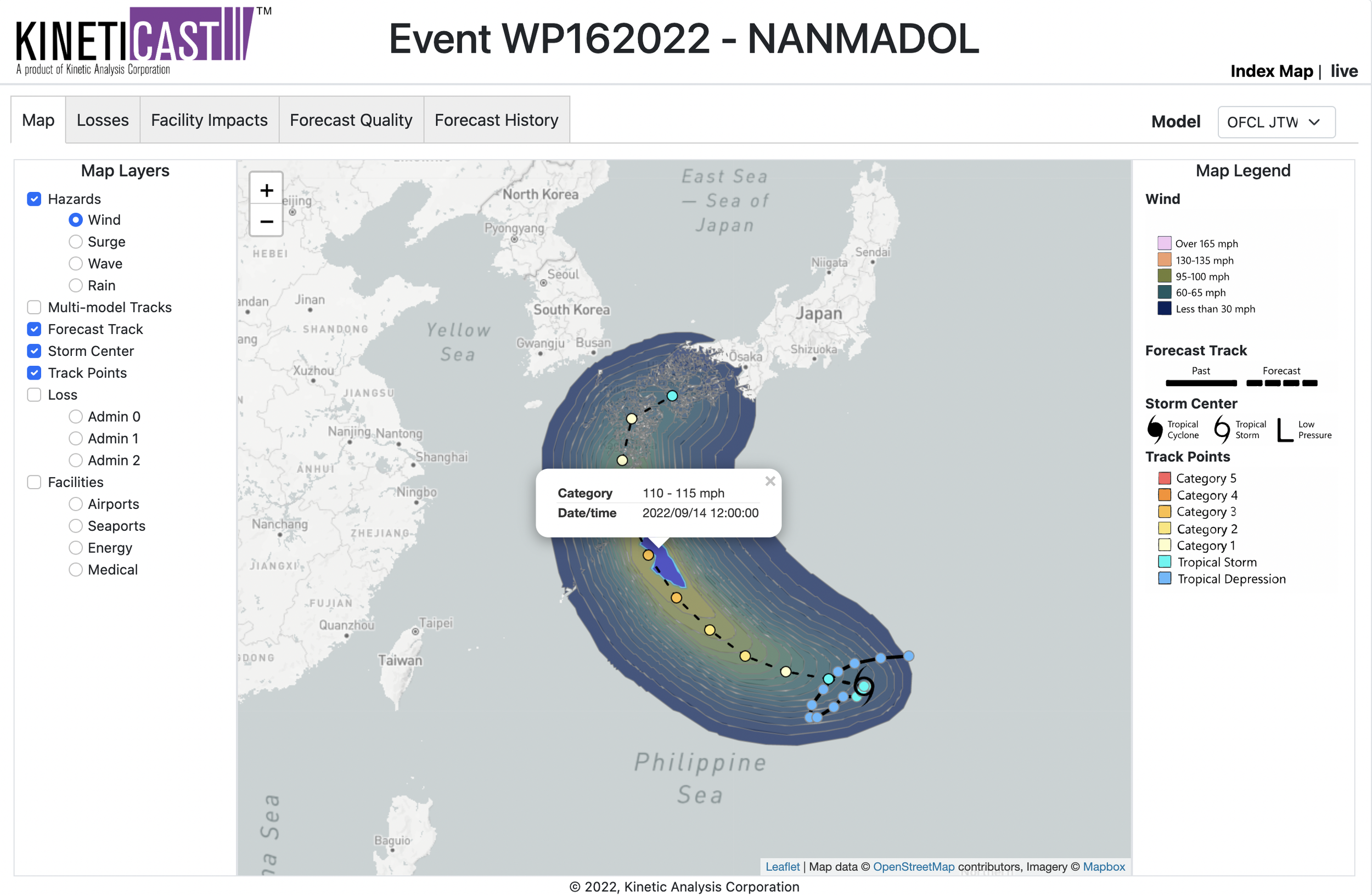
Forecast wind swath of Nanmadol modeled using inputs from the JTWC official forecast as displayed on KinetiCast™.
Over the next week, Nanmadol will pose a threat to Japan, a country that is already familiar with this year’s hurricane season. The current forecast from JTWC puts Nanmadol at a category 1-equivalent storm at the time of landfall. For it, KinetiCast™ is estimating that Japan will see losses of 2.648 billion PPP in USD. To see how the storm Based on the current JTWC forecast, losses are estimated at to be over 2 billion PPP in USD to Japan. To track changes in the forecast losses and impacts in real-time, please reach out to sales@kinanco.com.


