Tropical Storm Blas geography quiz
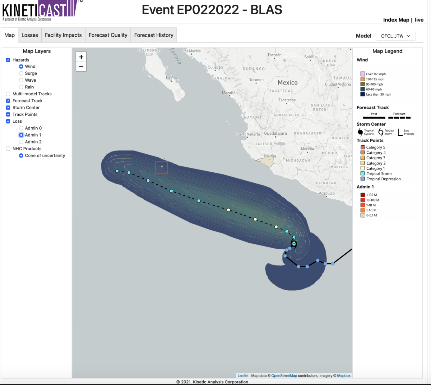
Below is the KinetiCast wind footprint consistent with Advisory 2 issued by the National Hurricane Center for Tropical Storm Blas.
Geography Quiz! Do you think that Mexico could be affected by the winds? Yes or No?
Tropical Storm Blas winds computed using National Hurricane Center Advisory 2 and Kinetic Analysis models.
Time’s up. If you answered yes, then congratulations, you when the geography knowledge prize! The Revillagigedo Islands, a UNESCO Nations World Heritage Site, could be subject to winds from Tropical Storm Blas. The red square in the image below shows the location Isla Socorro.
Location of Isla Socorro shown near center of red square.
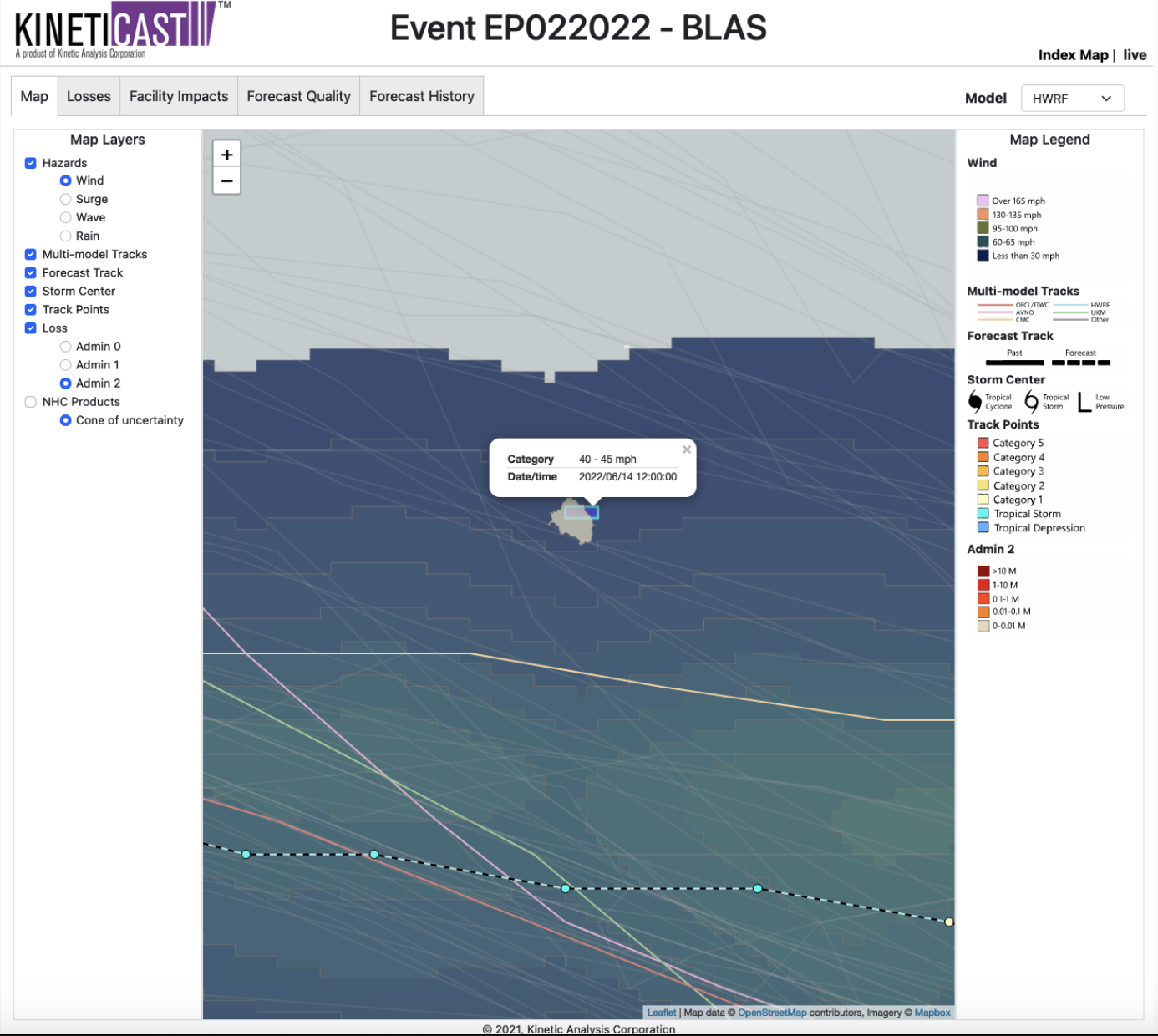
The example below is zoomed into the area around Isla Socorro. You can get an idea of how our wind results include the influence of surface roughness and topography on the wind field. For example, the winds tend to accelerate around the island cliffs. In this case, we’re looking at the wind footprint based on model guidance from the HWRF model. The HWRF track is the dashed line with dots. The other colored lines show the NHC track and tracks from models available from the US National Oceanic and Atmospheric Administration’s (NOAA) Global Forecast System Model, the Canadian Meteorological Center, and the United Kingdom’ Met Office. In fact, KinetiCast offers track data guidance from over 20 different models, providing you with a uniquely comprehensive multi-model view.
Highlight of faster wind speeds over Isla Socorro.
The losses from Tropical Storm Blas are, fortunately, sort of blah. But, with the ongoing season for hurricanes in the Atlantic and eastern Pacific, and for typhoons in the western North Pacific, there is no guarantee of a “blah” future. Accordingly, if you are interested in tools provided with the KinetiCast web app, please reach out to sales@kinanco.com.


