
December Temblor In Northern California
Early this morning, around 2:30am PST, a M6.4 earthquake occurred off the coast, south of Eureka in Northern California. The earthquake ruptured at a depth of approximately 18 km. A significant portion of PG&E’s customer base lost electricity. According to Poweroutage.us at 11:30 am 70% of tracked customers are still without power. Not the greatest way to move into the holiday season.
As shown in the figure below, there were areas with significant amounts of ground shaking as characterized by the Modified Mercalli Index (MMI).
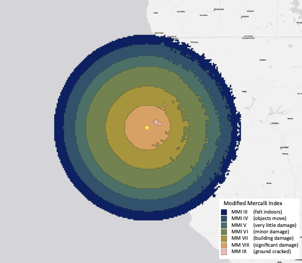
Spatial distribution of ground shaking as characterized by the Modified Mercalli Index. Note the small area with MMI IX which implies ground cracking.
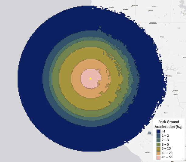
Consistent with the rather significant MMI, peak ground acceleration was between 20 and 50% of g, where g is the acceleration due to gravity.
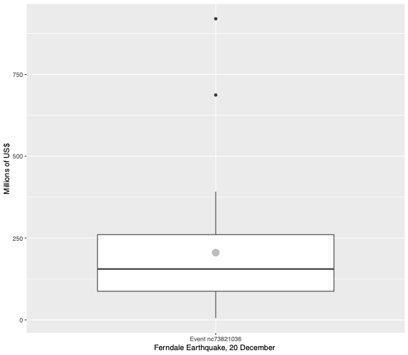
Given the relatively high peak ground acceleration, modeled damage estimates are high given the population density in the area. Kinetic Analysis median damage estimate is ~$150 million. The figure below shows the distribution of losses based on 33 different combinations of ground motion prediction equations and two exposure models.
If you’re interested in learning more about real-time hazard products available through Kinetic Analysis Corporation, send an email to sales@kinanco.com.