
Hurricane Debby Makes Landfall in Florida
Hurricane Debby made landfall this morning in the Big Bend region of Florida with maximum winds near 80 miles per hour. This is a very storm-surge prone area of coastline; our web app shows that 6 to 9 feet of storm surge may have occurred in portions of the Big Bend.
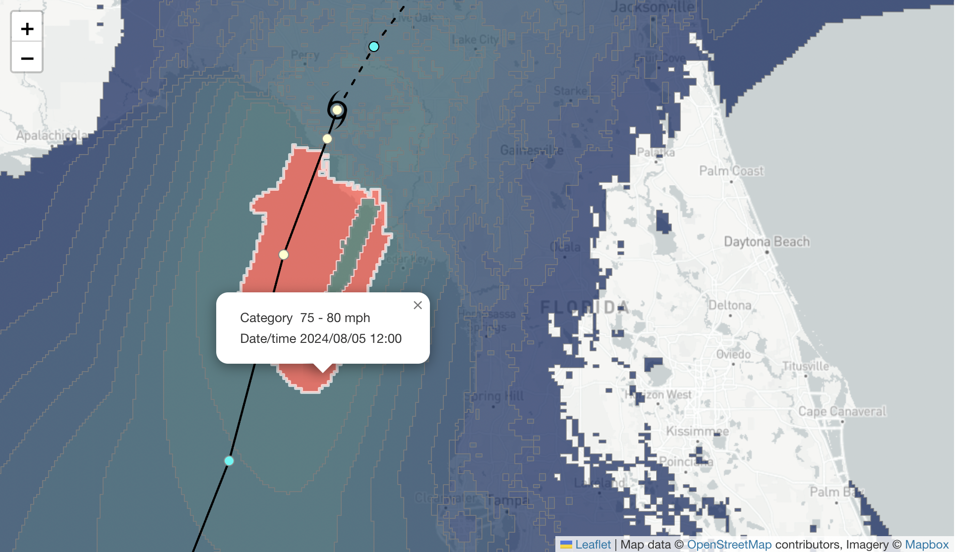
KinetiCast wind field from Hurricane Debby. Highlighted in red is a region where winds of 75 - 80 miles per hour are expected to have occurred.
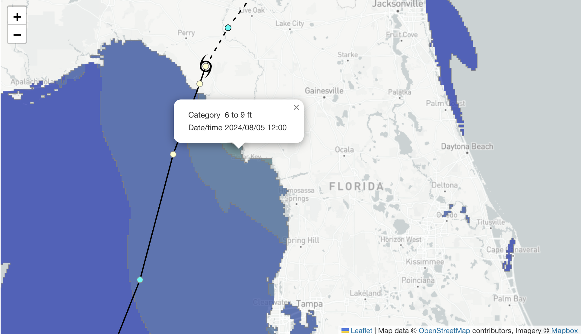
KinetiCast predicted storm surge from Hurricane Debby. As much as 6 to 9 feet of storm surge is expected to have occurred in a region near and north of Cedar Key, Florida.
The big story with Debby, though, will be the rainfall. Significant flooding has already been reported throughout the Florida Peninsula, with multiple flash flood warnings being issued. The worst of the flooding is yet to come, unfortunately, as potentially 20 to 30 inches of rain may fall over parts of the southeastern U.S., including cities such as Savannah and Charleston.
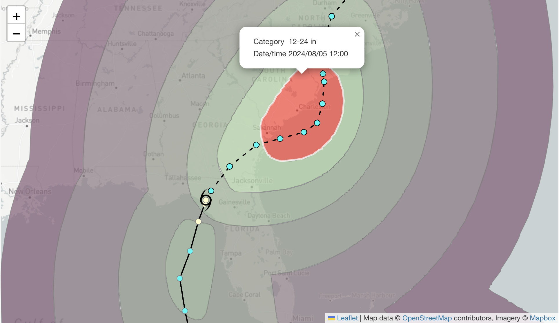
KinetiCast predicted cumulative rainfall from Debby. The area highlighted in red shows the potential for 12 to 24 inches of rain to fall over the lifetime of this storm.
We'll continue to provide updates this week as the situation unfolds in the southeast U.S. If you are interested in learning more about how our real-time web app can help you prepare yourself and your assets from the hazards of tropical cyclones, please reach out to us at sales@kinanco.com.